


|
A number of
maps and books have been prepared by the Department of Conservation
and Land Management, some of which are described below.
|
|
| A Guide to the Bibbulmun Track : Northern Half 10.110.0157 | |
|
This is the first of a completely new, full colour, two volume set. It is the essential companion for walkers tackling any portion of the first 470 kilometres of upgraded and re-aligned track between Kalamunda and Donnelly River Village. Divided into 30 consecutive track sections of between 10 and 20 kilometres, each has its own superbly detailed map, comprehensive track notes, distances and background information including vehicle access and terrain profiles. The guide also contains a wealth of other useful information including advice about trip planning, equipment, suggestions for short walks, distance tables, handy hints and overviews of the natural and human history associated with the track. |
 |
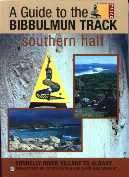
| A Guide to the Bibbulmun Track: Southern Half 10.110.0160 | |
|
This is the second of a, full colour, two volume set. It is the essential companion for walkers tackling any portion of the southern half of the Track between Donnelly River Village and Albany. Divided into 28 consecutive track sections, of between 10 and 25 kilometres, each has its own superbly detailed map, comprehensive track notes, distances and background information, including vehicle access and terrain profiles. The guide also contains a wealth of other useful information such as advice about planning your trip, the equipment to take, suggestions for short walks, distance tables, handy hints and overviews of the natural and cultural history associated with the Track. Along with its companion this volume is indispensable for anyone planning a walk on the Bibbulmun Track- be it for one hour, one day or one month. |
 |
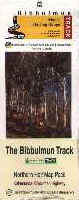
| Set of 4 maps of the Northern Half of the Bibbulmun Track 10.110.0138 | |
|
This series of four full colour fold out maps for the northern half of the Bibbulmun Track provides both background information about the Track and all the geographical data needed to undertake a safe and enjoyable walk on the the new Track. The maps provide distances between campsites, towns and road crossings and feature informative profiles of each section. |
 |
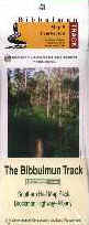
| Set of 4 maps of the Southern Half of the Bibbulmun Track 10.110.0156 | |
|
This series of four full colour fold out maps for the southern half of the Bibbulmun Track provides both background information about the Track and all the geographical data needed to undertake a safe and enjoyable walk on the new Track. The maps provide distances between campsites, towns and road crossings and feature informative profiles of each section. |
 |
| Full colour Bibbulmun Track Maps (Separate) | |
|
The eight maps in the two sets above are also available separately, the areas they cover are:
|
|
 |
|